WordPress Plugin for Google Maps – WP MAPS PRO 6.0.4
Recently Updated
100% Original Product & Well Documented
♥ Loved by Many!
7 sales

GPL License
Original price was: $89.00.$3.99Current price is: $3.99.
- Verified from VirusTotal
- 100% Original Product and Virus Free.
- Free New Version Lifetime On Single Purchase.
- Unlimited Website Usage
- Price is in US dollars and included tax
Sale will end soon

SSL Secured Checkout





Verified From
![]()
![]()
- Products Are Purchased and Downloaded From Original Authors.
- The File is 100% Completely Untouched and Unmodified.
- Last Update: 18.July.2025
- Version: 6.0.4

Premium Membership
Download this product for FREE and also gain access to 5,000+ premium themes and plugins.

Secure Transaction
Your transaction is secure with the Stripe. One of the famous payment gateway
Virus Free
Our all items on our website are Virus free and tested with "McAfee Secure"
Timely Update
After publishing the new update from author we upload the latest file on our website
Product Description and Reviews
WordPress Plugin for Google Maps – WP MAPS PRO Latest Version
This is a GPL-distributed version. No official support. Clean, secure, and legally redistributed under the GPL license.
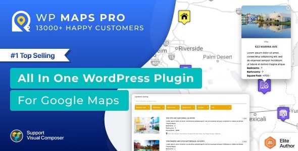
This Google Maps Plugin for WordPress is the most advanced Google Maps plugin ever created. We developed it using feedback from thousands of our valued customers.
Advanced Google Maps Customization Services
We do lots of customisation to all of our plugins present in our portfolio to meet specific needs/requirements/business goals of our customers. Feel free to discuss your customization requirements by contacting us Here or you can drop an email to us at support@flippercode.com. Our team will get back to you asap.
Advanced Google Maps Plugin Features
- Filter locations by custom fields, taxonomies & location data easily. Create multiple filters using the backend.
- Display posts, pages, or custom posts type on google maps. You can display multiple posts type on a single google map.
- Assign a location to your post easily using meta box or your own custom fields. You can use the Advanced Custom Fields plugin to assign a location to your post as well.
- Display posts information e.g title, content, excerpt, featured image, categories, tags, custom fields, or custom taxonomies in the info window. You just need to use placeholders to display these data.
- Display posts listing below the map and show post information in the listing. You can customize HTML easily to integrate your own design.
- Display posts or locations below the map in grid or list format. Visitors can switch format at the front-end.
- Add any number of information in location or marker details and display them in an info window easily. e.g fax, phone, email, website, etc.
- Import unlimited location data from CSV. You can import any number of fields in the location. Assign categories to your location using csv. All CSV delimiters supported.
- Assign multiple categories to a location and allow visitors to filter by categories.
- Choose to redirect to a location or display info window message on marker click for both posts or manually added locations.
- A complete listing module to filter, sort, print and advanced search box to filter posts or locations by zip, address, city, country, post tile or location title and categories.
- The listing module is ajax based for the fastest search experience and usability.
- Search posts or locations nearby within certain radius. Customize radius settings in the backend.
- Filter locations/markers by category on the map. Ability filters to multiple categories at once.
- Sort listing by title, address or category in both ascending and descending order.
- Print filtered location listing. You can control the print option via the backend.
- Placeholders to modify location listing data without any programming.
- Enable or disable search form, category filter, print option, sorting options in the backend.
- Listing module is pagination supported. You can decide # of posts or locations per page using the backend setting.
- Ask start location and end location from visitors to show route directions. Click on the marker to automatically fill start location. Get driving, bicycling, walking or transit route information.
- Visitor can get route directions in both miles and kilometres.
- Display start location input as textbox or select box filled with your locations.
- Display end location input as textbox or select box filled with your locations.
- Ability to display default Start and End location in directions tab.
- Get nearby places within certain radius using google places api.
- Display Circle around amenities found using google places api.
- Enable marker clusters if you have too many locations. Just activate and the plugin will handle the rest.
- You can apply marker clustering on both posts and locations. Marker cluster will be updated automatically on filtration.
- Choose marker cluster icons and mouseover icons to improve user experience. 10 marker cluster styles are available
- Choose marker cluster grid size and max zoom level.
- Create routes in the backend and display them on the front end. You can assign a color to each route. Visitors can show/hide routes on the front-end using the route filter form. You can display multiple routes on a google maps.
- Customize Stroke Color, Stroke Opacity, Stroke Weight, Travel Modes, Unit Systems, Start Location, End Location and waypoints to create a route.
- Make route draggable and optimize waypoints to suggest the best possible route.
- Assign waypoints to the route. Searchable location listings is added to assign waypoints to the route quickly.
- Admin can draw any number of circles, rectangles, polygons or polylines and display them on google maps. Shapes are clickable.
- Display an info window on click on a shape.
- Redirect to a location on click on a shape.
- Delete individual shapes or modify the property of the shape by selecting on click.
- Draw any number of shapes on the map and save all of them together.
- Use your own coordinates to draw shapes.
- Apply awesome Google Maps styles from snazzymaps.com with a simple copy and paste.
- You can create your own custom styles as well for roads, labels or geometry for your own google maps skin.
- Fetch locations from external data sources e.g custom tables or API and automatically assign to map using hooks.
- Ability to fetch latitude, longitude, city, country, state and zip code automatically when you type an address in the input field.






















Reviews
There are no reviews yet